| 1.4. Input stations coordinates | ||
|---|---|---|
| Chapter 1. Quick start guide | | |
| 1.4. Input stations coordinates | ||
|---|---|---|
| Chapter 1. Quick start guide | | |
Double click the icon left of the line name. Line data table will open in the main desktop area. Fill-in coordinates, i.e. latitude, longitude and altitude for each station:
| Note | |
|---|---|
You can import stations coordinates in batch from a coordinates file. Please follow the Import coordinates guide. Software accepts CSV-formatted data or data pasted to a text file from the Magellan GNSS Solutions software. |
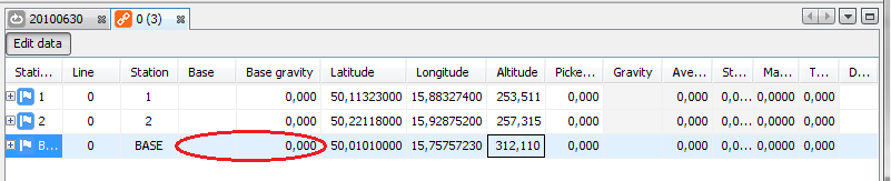
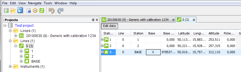
As the final step, set the absolute gravity for the base station and click the Base column for the BASE station:
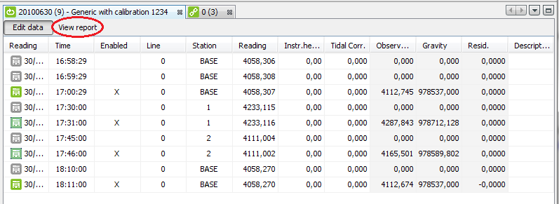
Gravity base is marked and the gravity loop is solved. Green icons signal solved loop and line with all stations having at least one gravity result. In the Loop table, dark green gravity reading icon means single reading for the station while light green means in-loop or cross-loop repetition:
| | ||
| 1.3. Input gravity data | 1.5. View and export results |