| Introduction | ||
|---|---|---|
| | ||
| Introduction | ||
|---|---|---|
| | ||
Blue Whale Processing is a Geophysical Software Solution for converting raw potential field data into fully corrected map formats for interpretation by the end user and incorporation into Geographic Information Systems.
Being both user friendly and cost effective, Blue Whale Processing Geophysical Software is being developed as an universal system for the treatment of potential field data from a variety of geophysical techniques to provide a flexible standard presentation that can be incorporated in modeling and presentation of geophysical parameters in a variety of applications, including minerals and hydrocarbon exploration, civil engineering, archaeology, and any GIS related application. Its initial development have been directed at gravity data, which incorporates more parameters and requires more complex processing than most geophysical and other potential field data
Applications:
in-field data processing, quality check, daily reporting
project post-processing, final gravity reductions & corrections
interpretation stage solution
Main features:
spreadsheet-style data editing
straightforward data processing
import gravity data in the Scintrex CG-3/CG-5 format
Lacoste & Romberg gravity meter instrument calibration tables support
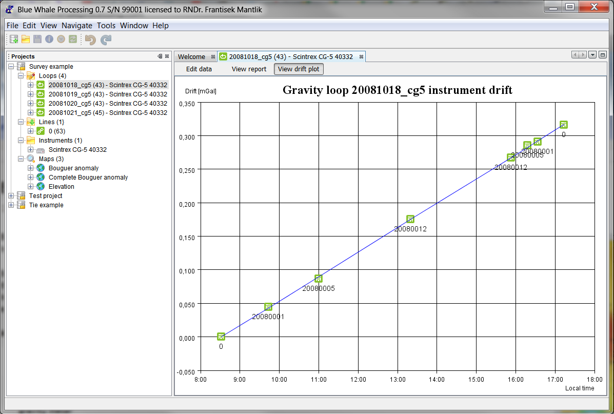
built-in Earth's tides corrections calculation
live repetitions statistics for easy and reliable quality check
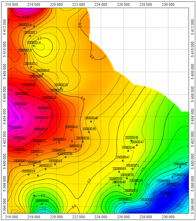
automatic computation of absolute gravity, free-air anomalies, Bouguer anomalies and terrain corrections
customizable loop reports in HTML format
powerful mapping module - presentation of processing results on the fly at each project stage
processed data export in CSV format compatible with most geo-science applications
System requirements:
Microsoft Windows XP/Vista/7/8, Mac OSX 10.5+ or Linux 2.6
Sun Java JRE 1.6 or newer
minimum 1024 Mbyte RAM (2048 Mbyte recommended) and 100 Mbyte HDD free space
one free USB port
| | ||
| Blue Whale Processing Geophysical Software | Chapter 1. Quick start guide |